October 18, 2023 - Annual Foliage Flight
Day Two - Part Three
N. Aroostook to Houlton to Millinocket
|
| I departed Northern Aroostook and headed southeast down Long Lake. |
| |
 |
|
|
An interesting inhabited island in the middle of Long Lake. Made possible by that long bridge down below.
|
| |
 |
|
| That's Canada out there to the northeast. |
| |
 |
|
|
A little bit of color remains.
|
| |
 |
|
| I approach what used to be Loring Air Force Base. The runway runs north-south and is only three nautical miles from the Canadian border to the east. |
| |
 |
|
| Loring used to be one of the largest bases of the U.S. Air Force's Strategic Air Command during the Cold War. I can believe it. The main runway is 12,000 feet long. |
| |
 |
|
|
The old control tower remains. The airport is now know as Loring International (ME16) and is privately owned by the Loring Development Authority, whatever that is.
I didn't see a single plane on the entire massive grounds.
|
| |
 |
|
|
The base's origins began in 1947 with an order for construction of an airfield. The chosen site, in northeastern Maine, was the closest point in the continental U.S. to Europe, providing high strategic value during the Cold War.
That huge Arch Hangar in the lower left-hand corner, when built in 1949 was the largest arch roof structure in the country, capable of servicing two B-36 bombers simultaneously.
|
| |
 |
|
| For the majority of its operational lifetime, Loring was a heavy bomber, aerial refueling, and interception facility for military aircraft, equipment, and supplies first as part of Strategic Air Command (SAC) (1947–1992), then as part of the succeeding Air Combat Command (ACC) (1992–1994) |
| |
 |
|
|
Chalk outlines on the ramp of the two main planes at Loring: the B-52 bomber and the KC-135 refueling tanker.
There is only the one 12,000 foot long runway -- 1/19.
|
| |
 |
|
|
The 1991 Base Realignment and Closure Commission recommended that Loring be closed and its aircraft and mission be distributed to other bases in the nation. The base was closed in September 1994 after over 40 years of service.
But there are hopes for the airport. See the following story.
|
| |
 |
|
| Loring was home to a civilian population, many of whom were employed alongside active duty service members. The base included many amenities, some pictured below, such as a hospital, school, and ski hill, which facilitated the adjustment to Maine life by the civilians. |
| |
 |
|
|
From Loring, I flew a few miles southwest over to the little town of Caribou and its airport Caribou Muni (KCAR).
|
| |
 |
|
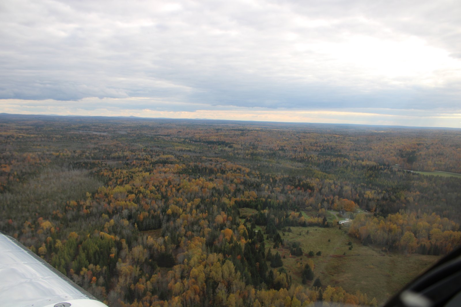
| Then I continued south. As you can see, northeast Maine is developed and not wilderness like the northeast. |
| |
 |
|
|
Following the winding Aroostook River which runs from Caribou to Presque Ise.
|
| |
 |
|
| Speaking of which, there is the town of Presque Isle and the Presque Isle International Airport at right. |
| |
 |
|
|
A closer look at the airport which was established in 1931. It was expanded within the decade and later assumed major military importance. The Presque Isle Air Force Base, in operation between 1941 and 1961, was a major departure point for U.S. fighter planes during World War II and the Korean War due to its relative proximity to Europe. When the base was sold, a piece of it became the Northern Maine Regional Airport. In June 2018, the Northern Maine Regional Airport was renamed Presque Isle International Airport.
For those of you who don't know, all "International" means is that customs and border patrol agents are based at the airport, and therefore it is an airport you can land at when flying in from another country.
The airport was fairly busy so I gave it a wide berth.
|
| |
 |
|
| A major intersection in the middle of nowhere. But if you look closely there is only one road -- probably Highway One. Most of the action is the railroad which goes three directions. |
| |
 |
|
|
I headed southwest back out into the wilderness to check out Scopan Lake.
|
| |
 |
|
| Scopan Lake. |
| |
 |
|
|
Now that I'm further south, the color has come back somewhat.
|
| |
 |
|
| |
| |
 |
|
|
Now headed southeast, direct for Houlton.
|
| |
 |
|
| A lot of leaf droppage has occured. |
| |
 |
|
| The town of Houlton is dead ahead. I flew here last year to check it out from the air but didn't land. Today I will land. That's Interestate 95 at lower left. Houlton is the end of the road for I-95. It runs east into Canada, which is only a mile away from here. |
| |
 |
|
| There is Houlton International Airport (KHUL). On the far side is Canada. I wanted to land on runway 23 which has a left-hand pattern. But that would put me in Canadian airspace! So I flew a right-hand pattern. But then I got a good look at the windsock which favored runway 5, so I made a 180 and flew a left-hand pattern into runway 5. On the ground, the airport manager told me the airspace wasn't a problem, you could fly in Canadian airspace as long as you didn't land or go ten miles or so in. |
| |
 |
|
|
On left base for runway Five at Houlton. A thousand feet from the end of runway Five is where Interstate 95 crosses into Canada and there are a bunch of border crossing stations.
|
| |
 |
|
| The FBO Building at Houlton. |
| |
 |
|
|
Nice place. Since I didn't need gas, to give them some business I bought a T-shirt.
|
| |
 |
|
| On the ramp at Houlton. |
| |
 |
|
| Millinocket is only 47nm to the southwest from Houlton. I'd had enough flying for the day so I headed direct across the Maine woods. |
| |
 |
|
| There was a broken layer but enough sun filtered through to light things up. |
| |
 |
|
|
Typical Maine scene: water, trees, mountains.
|
| |
 |
|
| |
| |
 |
|
|
Nice way to end the day.
|
| |
 |
|
| |
| |
 |
|
| |
| |
 |
|
| Passing by a little bit of civilization. |
| |
 |
|
|
Looking northeast at I-95 as it heads towards Houlton.
|
| |
 |
|
|
And looking south as it heads towards Florida.
Millinocket is only ten miles or so off I-95, to the west.
|
| |
 |
|
|
Some weather building.
|
| |
 |
|
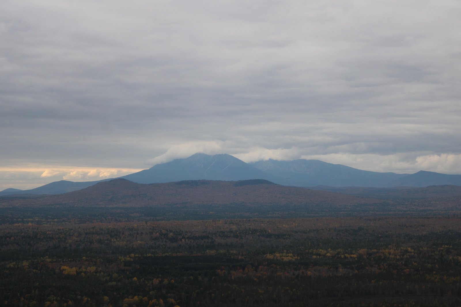
| And there is Mount Katahdin, with it's own private cloud obscuring the peak. |
| |
 |
|
| Close-up. I would not see the summit this year. |
| |
 |
|
| Over Millinocket, looking down at the motel I stayed at last night -- center right. Many of the stores below are closed. |
| |
 |
|
|
Tonight I stayed at the Hotel Terrace, where I stayed last year. I would have stayed here both nights but Booking.com had nothing available the first night. I assumed they were booked. But the manager told me they weren't; next time I should call. Hotel Terrace is less expensive than the Katahdin Inn I stayed at last night.
The Hotel Terrace had a breakfast/lunch restaurant that I enjoyed last year; sadly, they closed last spring. Kind of depressing.
|
| |
 |
|
| Walking into Millinocket for dinner. |
| |
 |
|
|
Passing yet another closed business. This one was a Used Car place.
|
| |
 |
|
| Main Street Millinocket. Actually it is named Penobscot Avenue. Regardless, it is deserted. |
| |
 |
|
| I saw two Chester's chicken places in Millinocket; both closed. |
| |
 |
|
| Like I did last year, I had dinner at the Scootic Inn on Penobscot Avenue. |
| |
 |
|
| This year I decided that since I was in Maine, I should have some lobster, so I had a Lobster Roll. It was very good! |
| |
 |
|
| My track for today. I did a fairly good job of flying the perimeter of northern Maine. |
| |
 |
|
| |
| |
|
|
|
|
|
|